Scientists using GPS to study changes in the Earth’s shape accurately forecasted the size and location of the magnitude 7.6 Nicoya earthquake that occurred in 2012 in Costa Rica.
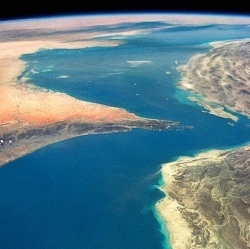
The Nicoya Peninsula in Costa Rica is one of the few places where land sits atop the portion of a subduction zone where the Earth’s greatest earthquakes take place. Costa Rica’s location therefore makes it the perfect spot for learning how large earthquakes rupture.
Because earthquakes greater than about magnitude 7.5 have occurred in this region roughly every 50 years, with the previous event striking in 1950, scientists have been preparing for this earthquake through a number of geophysical studies. The most recent study used GPS to map out the area along the fault storing energy for release in a large earthquake.
"This is the first place where we’ve been able to map out the likely extent of an earthquake rupture along the subduction megathrust beforehand," said Andrew Newman, an associate professor in the School of Earth and Atmospheric Sciences at the Georgia Institute of Technology.
The study was published online Dec. 22, 2013, in the journal Nature Geoscience. The research was supported by the National Science Foundation and was a collaboration of researchers from Georgia Tech, the Costa Rica Volcanological and Seismological Observatory (OVSICORI) at Universidad Nacional, University California, Santa Cruz, and the University of South Florida.
Subduction zones are locations where one tectonic plate is forced under another one. The collision of tectonic plates during this process can unleash devastating earthquakes, and sometimes devastating tsunamis. The magnitude 9.0 earthquake off the coast of Japan in 2011 was due to just such a subduction zone eaerthquake. The Cascadia subduction zone in the Pacific Northwest is capable of unleashing a similarly sized quake. Damage from the Nicoya earthquake was not as bad as might be expected from a magnitude 7.6 quake.
"Fortunately there was very little damage considering the earthquake’s size," said Marino Protti of OVSICORI and the study’s lead author. "The historical pattern of earthquakes not only allowed us to get our instruments ready, it also allowed Costa Ricans to upgrade their buildings to be earthquake safe."
Plate tectonics are the driving force for subduction zones. As tectonic plates converge, strain temporarily accumulates across the plate boundary when portions of the interface between these tectonic plates, called a megathrust, become locked together. The strain can accumulate to dangerous levels before eventually being released as a massive earthquake.
"The Nicoya Peninsula is an ideal natural lab for studying these events, because the coastline geometry uniquely allows us to get our equipment close to the zone of active strain accumulation," said Susan Schwartz, professor of earth sciences at the University of California, Santa Cruz, and a co-author of the study.