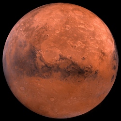
A new map of Mars’ gravity made with three NASA spacecraft is the most detailed to date, providing a revealing glimpse into the hidden interior of the Red Planet. "Gravity maps allow us to see inside a planet, just as a doctor uses an X-ray to see inside a patient," said Antonio Genova of MIT.
"The new gravity map will be helpful for future Mars exploration, because better knowledge of the planet’s gravity anomalies helps mission controllers insert spacecraft more precisely into orbit about Mars. Furthermore, the improved resolution of our gravity map will help us understand the still-mysterious formation of specific regions of the planet."
The improved resolution of the new gravity map suggests a new explanation for how some features formed across the boundary that divides the relatively smooth northern lowlands from heavily cratered southern highlands. Also, the team confirmed that Mars has a liquid outer core of molten rock by analyzing tides in the Martian crust and mantle caused by the gravitational pull of the sun and the two moons of Mars.
Finally, by observing how Mars’ gravity changed over 11 years, the period of an entire cycle of solar activity, the team inferred the massive amount of carbon dioxide that freezes out of the atmosphere onto a Martian polar ice cap when it experiences winter. They also observed how that mass moves between the south pole and the north pole with the change of season in each hemisphere.
The map was derived using Doppler and range tracking data collected by NASA’s Deep Space Network from three NASA spacecraft in orbit around Mars: Mars Global Surveyor (MGS), Mars Odyssey (ODY), and the Mars Reconnaissance Orbiter (MRO). Like all planets, Mars is lumpy, which causes the gravitational pull felt by spacecraft in orbit around it to change. For example, the pull will be a bit stronger over a mountain, and slightly weaker over a canyon.
Slight differences in Mars’ gravity changed the trajectory of the NASA spacecraft orbiting the planet, which altered the signal being sent from the spacecraft to the Deep Space Network. These small fluctuations in the orbital data were used to build a map of the Martian gravity field.
The gravity field was recovered using about 16 years of data that were continuously collected in orbit around Mars. However, orbital changes from uneven gravity are tiny, and other forces that can perturb the motion of the spacecraft had to be carefully accounted for, such as the force of sunlight on the spacecraft’s solar panels and drag from the Red Planet’s thin upper atmosphere. It took two years of analysis and computer modeling to remove the motion not caused by gravity.
"With this new map, we’ve been able to see gravity anomalies as small as about 100 kilometers (about 62 miles) across, and we’ve determined the crustal thickness of Mars with a resolution of around 120 kilometers (almost 75 miles)," said Genova. "The better resolution of the new map helps interpret how the crust of the planet changed over Mars’ history in many regions."
The new gravity field also allowed the team to confirm indications from previous gravity solutions that Mars has a liquid outer core of molten rock. The new gravity solution improved the measurement of the Martian tides, which will be used by geophysicists to improve the model of Mars’ interior.